Friday, July 30, 2021 Contacts: Media: BTSNews@dot.gov Technical: ntad@dot.gov
National Transportation Atlas Database Summer 2021 Adds Alternative Fuel Corridors Dataset, 11 Other Updates
The Summer 2021 update to the National Transportation Atlas Database (NTAD) was released today with the new Alternative Fuel Corridors dataset and 11 updated datasets.
The Alternative Fuel Corridors addition brings to 90 the total number geospatial datasets in the NTAD collection representing the nation's transportation infrastructure, containing roadways, railways, waterways, and airports. An additional 27 ancillary data tables can be used in this Bureau of Transportation Statistics (BTS) compilation.
The updates in this release are:
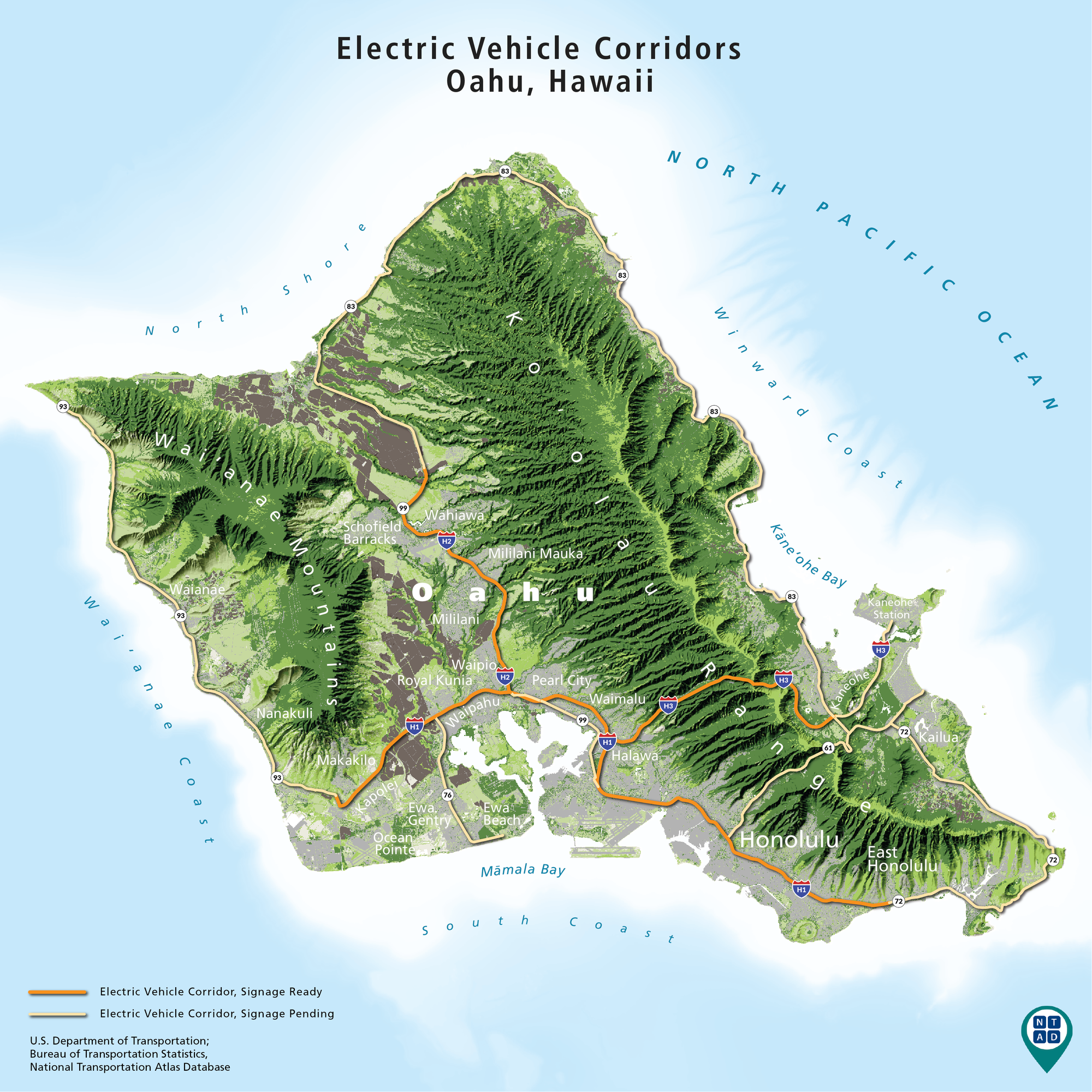
The new Alternative Fuel Corridors dataset contains a national network of alternative fueling and charging infrastructure along national highway system corridors. The map below shows electric vehicle corridors and a status of ready or pending for corridor signage on the island of Oahu, Hawaii. In this dataset, there are five types of alternative fuel corridor designations: Electric Vehicle (EV), Compressed Natural Gas (CNG), Liquefied Natural Gas (LNG), Liquefied Petroleum Gas (LPG) or Propane, and Hydrogen. Corridor-ready segments contain a sufficient number of fueling facilities to allow for corridor travel with the designated alternative fuel, and to qualify for highway signage. Corridors that do not have sufficient alternative fuel facilities to support alternative fuel vehicle travel are designated as corridor-pending.
NTAD is available for download in comma separated values (CSV), Keyhole Markup Language (KML), and shapefile formats through the BTS Geospatial Data Catalog. Additionally, Open Geospatial Consortium (OGC) standard Web Feature Services (WFS) (including Web Mapping Services (WMS)) are available for all NTAD datasets. For these specific dataset updates in this Summer release, however, new Web Feature Services (WFS) can be found here. Also available are optimized services that allow for fast rendering of full NTAD datasets, and vector tile services for 13 of the largest NTAD datasets. These full NTAD datasets and their respective faster services are designated by service names ending in "DS" for each layer, and the vector tiles service names ending in "VT".
BTS now uses a dynamic NTAD publication cycle, making updated data available throughout the year when they become available from their respective government agencies. Follow @TransportStats on Twitter for announcements of additional dataset releases throughout the year.
| ||||||||||||||||||
National Transportation Atlas Database Summer 2021 Adds Alternative Fuel Corridors Dataset, 11 Other Updates


Subscribe to:
Post Comments (Atom)
No comments:
Post a Comment